
Vector Based Model
เสนอ
ผศ.ดร.ณรงค์ พลีรักษ์
รายชื่อ
อาจารย์พิชิตพร ผลเกิดดี
รายชื่อ
นายจตุพร อุตรัตน์ 58170059 กลุ่ม 01
นายนราวิชญ์ ปิ่นวิเศษ 58170070 กลุ่ม 01
นายนิติภูมิ เยียนไธสง 58170072 กลุ่ม 01
นายภานุวัฒน์ สุทินเผือก 58170079 กลุ่ม 01
นายศักดิ์รพี รุ่งศรี 58170084 กลุ่ม 01
รายวิชานี้เป็นส่วนหนึ่งของวิชา ระบบสารสนเทศทางภูมิศาสตร์ 2 (876214)
ภาคเรียนที่ 2 ปีการศึกษา 2559
คณะภูมิสารสนเทศศาสตร์ มหาวิทยาลัยบูรพา
-------------------------------------------------------------------------------
Vector_Model
Content : การวิเคราห์พื้นที่ขอบเขตในเขื่อนป่าสักชลสิทธิ์ อ.พัฒนานิคม จ.ลพบุรี
-------------------------------------------------------------------------------
Vector_Model
Content : การวิเคราห์พื้นที่ขอบเขตใน
เขื่อนป่าสักชลสิทธิ์ อ.พัฒนานิคม จ.ลพบุรี
1.เปิดโฟเดอร์ข้อมูล vector_model ในเครื่องมือ Arc catalog


--------------------------------------------------------------------------------------
2.สร้างเครื่องมือเพิ่มเติมใน โฟเดอร์ vector แล้วตั้งชื่อ โพเดอร์ Lab_vector_model


--------------------------------------------------------------------------------------


*Output_Dataset

*จัดเรียงข้อมูลใหม่ในตาราง table of conten


--------------------------------------------------------------------------------------


*Open Attribute table
*Joine&realate


< Processing Finish >


<Processing>


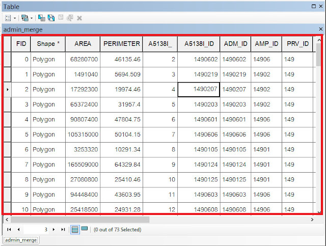
ดูข้อมูลที่การjoin ในข้อมูล Merge.shp ไว้แล้ว ใน ตาราง table of content


*Output
-------------------------------------------------------------------------------
คำนวนหา (ขนาดพื้นที่) ใน ตาราง Open Attribute


-------------------------------------------------------------------------------------


 นายนิติภูมิ เยียนไธสง 58170072 กลุ่ม 01


--------------------------------------------------------------------------------------
3.นำเข้าข้อมูลที่ชื่อว่า dam.shp เข้าในตาราง table of content
*Arctoolsbox > Browse > D:
>Vector_model>Lab_Vector_model
*select to >dam.shp>in table of content


--------------------------------------------------------------------------------------
4.การทำ Buffe
*geoprocessing > Buffer
*Input_Features> import_select >dam.shp
*Output_Feature> Browse to >Open to>look in : > D:
>Vector_model>Lab_Vector_model>Creat field>Name :
dam_buffer_500.shp>save as>OK
*distance [value or field] > select point to linear unit >
500 > unit to > Metters >ok


--------------------------------------------------------------------------------------
5.สลับข้อมูล .shp
field ในตาราง table
of content
*การจัดวาง
- dam.shp
[Top]
- dam_buffer_500.shp
[bottom]
*เพื่อดูความแตกต่างของข้อมูลได้ง่ายขึ้น


--------------------------------------------------------------------------------------
6.นำเข้า .shp
field ข้อมูลใน ตาราง table of content
- a5138i.shp
- a5338iii.shp
- a5238iv.shp
- a5239iii.shp


--------------------------------------------------------------------------------------
7.จัดวางของชั้นข้อมูลใหม่โดย สลับข้อมูล .shp field ในตาราง table of content
*การจัดวาง
- dam500.shp
- a5138i.shp
- a5338iii.shp
- a5238iv.shp
- a5239iii.shp
- dam.shp
*เพื่อดูความแตกต่างของข้อมูลได้ง่ายขึ้น


--------------------------------------------------------------------------------------
8.การทำ Merge

*Input_datasets> select to
- a5138i.shp
- a5338iii.shp
- a5238iv.shp
- a5239iii.shp

*Output_Dataset
Browse to >Open to>look in : > D:
>Vector_model>Lab_Vector_model>Creat field>Name : admin_Merge.shp>save
as>OK
<Processing fininsh>

<Processing fininsh>

*เมื่อทำการ Merge เสร็จแล้ว ให้ทำการ Remove ข้อมูล .shp ในตาราง Table
of content ออก

- a5138i.shp
- a5338iii.shp
- a5238iv.shp
- a5239iii.shp
- Table
of content > select Hightlight .shp > click right > remove
- *(หมายเหตุ : เพื่อง่ายต่าการวิเคราะห์ข้อมูล layer ข้อมูล ไม่ซับซ้อน)
*จัดเรียงข้อมูลใหม่ในตาราง table of conten
- ddmin_merge.shp
- dam_buffer_500.shp
- dam.shp
--------------------------------------------------------------------------------------
9.join&realate
*ดูความสัมพันธ์ของตารางก่อนทำการ join&realate ว่ามีความสัมพันธ์แบบใด
- One
to One
- One
to Many
- Many
to One
- Many
to Many
*admin_merge.shp
Table of content > click right > open attribute
table > check table data
*จากนั้นเปิดตาราง Open
Attribute table ดูเพื่อค่าข้อมูลของ admin_Merge.shp เพื่อทำการ join&relate ในครั้งต่อไป


*Import_data_.dbf
- Browse
to >Open to>look in : > D:>Vector_model>Lab_Vector_model
> Pasak > code
- นำเข้าข้อมูลในตาราง table of content
- luptv.dbf
- luamp.dbf
- lutam.dbf
- เข้าในตาราง Table of content
*Open Attribute table
- เปิดตาราง .shp มาเพื่อดูเปรียบเทียบข้อมูลว่าเป็นข้อมูลแบบใด
- luptv.dbf
- luamp.dbf
- lutam.dbf
- วิเคราะห์หัวข้อตาราง
- One
to One
- One
to Many
- Many
to One
- Many
to Many
- ดูความสัมพันธ์ของตารางเพื่อที่จะทำการ join&relat

*Joine&realate
*Part 1_luprv.dbf
Table Options
- Table
of content > admin_Merge.shp >Click right >Open attribute table
> table of Option >Join&realate>join
•Chooses the field in this layer that the join
will be based on : > select> PRV_ID
•Chooses the table to this layer that the join
will be based on : > select> luprv.dbf
•Chooses the field in the table to base the join on
: > select> PRV_ID
•OK
ดูข้อมูลที่การjoin ในข้อมูล admin_Merge.shp ไว้แล้ว ใน ตาราง table of content
เลือกดู Colum
: PRV_ID เช็คข้อมูลว่าทำการ Join เสร็จสมบูรณ์แล้วหรือไม่


*ดูความสัมพันธ์ของตารางก่อนทำการ join&realate ว่ามีความสัมพันธ์แบบใด แล้วจึงทำการ Join
- One to One
- One to Many
- Many to One
- Many to Many


< Processing Finish >
*Part_2_luamp.dbf
Table Options
- Table
of content > admin_Merge.shp >Click right >Open attribute table
> table of Option >Join&realate>join
•Chooses the field in this layer that the join
will be based on : > select> AMP_ID
•Chooses the table to this layer that the join
will be based on : > select> luamp.dbf
•Chooses the field in the table to base the join on
: > select> AMP_ID
•OK


ดูความสัมพันธ์ของตารางก่อนทำการ join&realate ว่ามีความสัมพันธ์แบบใด แล้วจึงทำการ Join
- One to One
- One to Many
- Many to One
- Many to Many


<Processing>

*ดูข้อมูลที่การjoin ในข้อมูล admin_Merge.shp ไว้แล้ว ใน ตาราง table of content
เลือกดู Colum : PRV_ID เช็คข้อมูลว่าทำการ Join เสร็จสมบูรณ์แล้วหรือไม่
*Part_3_lutam.dbf
Table Options
- Table
of content > admin_Merge.shp >Click right >Open attribute table
> table of Option >Join&realate>join
•Chooses the field in this layer that the join
will be based on : > select> ADM_ID
•Chooses the table to this layer that the join
will be based on : > select> lutam.dbf
•Chooses the field in the table to base the join on
: > select> ADM
•OK


ดูข้อมูลที่การjoin ในข้อมูล Merge.shp ไว้แล้ว ใน ตาราง table of content
เลือกดู Colum
: ADM_ID เช็คข้อมูลว่าทำการ Join เสร็จสมบูรณ์แล้วหรือไม่
--------------------------------------------------------------------------------------
10.การทำ clip
10.การทำ clip
*geoprocessing > clip

*input_Features
Select>admin.shp
*clip_Feature
Select>dam_buffer_500.shp

*output_features
Browse to >Open to>look in : > D:
>Vector_model>Lab_Vector_model>Creat field>Name :
admin_clip_500.shp>save as>OK
<Processing finish>
*การแสดงผลในการ clip

*การแสดงผลในการ clip
Table of content > un select


admin_merge.shp
dam_buffer_500.shp
dam.shp
Finish Display
--------------------------------------------------------------------------------------
11.การรวมพื้นที่ขอบเขต
Landuse data
การใช้ประโยชน์ที่ดินในขอบเขตเขื่อนป่าสักชลสิทธิ์
Import_data
Arctooolsbox> Browse > D:
>Vector_model>Lab_Vector_model

*select to >
l5239iii.shp
l5238iv.shp
5238iii.shp
l5138i.shp
>in table of content


--------------------------------------------------------------------------------------
12.การทำการ Merge ข้อมูล landuse
*Geoprocessing > Merge

*Geoprocessing > Merge

*Input_datasets
Select to .shp >
l5239iii.shp
l5238iv.shp
5238iii.shp
l5138i.shp


*output_dataset
Browse to >Open to>look in : > D:
>Vector_model>Lab_Vector_model>Creat field>Name :
landused_Merge.shp>save as>OK
<Processing>

<Display finish>
<Processing>

<Display finish>
--------------------------------------------------------------------------------------
13.การทำ clip
landused_Merge , admin_500
*geoprocessing>clip


*Input_feature
Select>landused_merge
*Clip_feature
Admin_clip_500.shp


*Output
Browse to >Open to>look in : > D:
>Vector_model>Lab_Vector_model>Creat field>Name :
landused_clip_500.shp>save as>OK

<processing>


Display finish
--------------------------------------------------------------------------------------
14.การทำ Intersect
*geoprocessing>Intersect


*Input_feature
Select>
- landused_Merge
- dam_buffer_500

*Output
Browse to >Open to>look in : > D:
>Vector_model>Lab_Vector_model>Creat field>Name :
landused_intersect.shp>save as>OK
<processing>


Display finish
-------------------------------------------------------------------------------
15.การสร้างเพิ่ม ใน Join โดยข้อมูล lucode.dbf ใน landuse_intersect.shp เพื่อหาขนาดหมวดประเภทของพืชพรรณ


<Processing >
<Display finish>

<Processing >
<Display finish>
--------------------------------------------------------------------------------------
16.การสร้างเพิ่ม ใน Open Attribute table โดยสร้างใน landuse_intersect.shp เพื่อหาขนาดพื้นที่ (Aear)
Import
*lucode.dbf> in table of content

*Open Attribute table landused.shp , lucode.dbf


ดูความสัมพันธ์ของตารางก่อนทำการ join&relate ว่ามีความสัมพันธ์แบบใด แล้วจึงทำการ Join
- One to One
- One to Many
- Many to One
- Many to Many


<Processing >
<Display finish>

<Display finish>
--------------------------------------------------------------------------------------
16.การสร้างเพิ่ม ใน Open Attribute table โดยสร้างใน landuse_intersect.shp เพื่อหาขนาดพื้นที่ (Aear)
*table of content >landuse_intersect.shp>click
right>Option table>Add fiele>Name:Aear>type: select> short
integer>Feild Properties : precision : _15_ > OK
คำนวนหา (ขนาดพื้นที่) ใน ตาราง Open Attribute
Content Field : Aear >cick left>Calculate Geometry>
Property: select Aear >OK


<Processing>


Display finish
Check number in colum :Aear
--------------------------------------------------------------------------------------
17.การสร้างตารางเพิ่ม ใน Open Attribute table โดยสร้างใน landuse_intersect.shp เพื่อหาขนาดพื้นที่ไร่ (Rai)
*table of content >landuse_intersect.shp>click right>Option
table>Add fiele>Name:Rai>type: select> short integer>Feild
Properties : precision : _15_ > OK
การคำนวนหา (ขนาดพื้นที่ไร่)ใน ตาราง Open Attribute
Content Field : Rai >cick left> Fied Calculate > Fieds
: select Aear >Discription : [Aear]/1600> OK


<Processing>
Display finish

Check number in colum :Rai
--------------------------------------------------------------------------------------
18.การดูข้อมูลผ่านโปรแกรมเอ็กเซลล์ ง่ายต่อการแสดงผล Microsoft Exel
*Open program Microsoft Exel>File>Open>Browse > D:
>Vector_model>Lab_Vector_model>select type : .dBase Files >select
name files :landuse_intersect.dBase Files>OK
*cick :Ctrl+A >Tab menu >insert >Pivot table > Ok
*Pivot table fieds
Select show display Attribute data
*Can Select Check all Field
สามารถเลือกดูข้อมูลต่างๆ ได้โดยง่ายโปรแกรม Exel
โดยเราจัดูข้อมูล
Select
- lucode_Ass
- Aear
- Rai


-------------------------------------------------------------------------------------

นายจตุพร อุตรัตน์ 58170059 กลุ่ม 01

นายศักดิ์รพี รุ่งศรี 58170084 กลุ่ม 01

นายภานุวัฒน์ สุทินเผือก 58170079 กลุ่ม 01

นายนราวิชญ์ ปิ่นวิเศษ 58170070 กลุ่ม 01

ความคิดเห็น
แสดงความคิดเห็น